
UK sat images of Somerset floods aid agencies' response

The images, which show serious flooding on the Somerset Levels, were taken when the UK activated the International Charter ‘Space and Major Disasters’ – an international effort to task Earth Observation (EO) satellites to provide free satellite data during natural emergencies.
Uniquely, the UK is a member of the Charter on a public-private basis that makes best use of the available government and commercial expertise. The UK Space Agency holds a seat on the Charter’s Board, providing policy direction and examining ways to improve Charter performance in future, and DMC International Imaging Ltd (DMCii) operates the Disaster Monitoring Constellation - a commercial satellite constellation made available as part of the Charter satellite fleet - and manages the UK operational contributions as a member of the Charter’s Executive Secretariat.

Satellite technology can make a tremendous difference in the immediate aftermath of an emergency, providing invaluable and immediate satellite images and data during times of crisis.
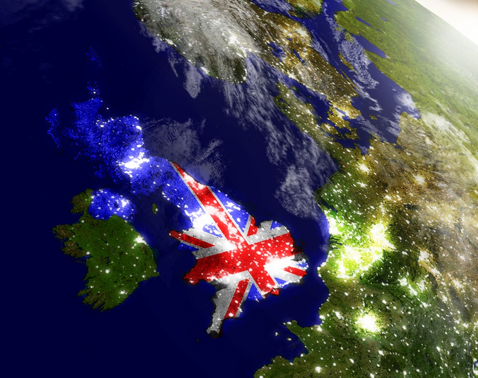
In the image of the Somerset Levels, acquired on 8 February 2014, we can clearly see where the River Parrett has burst its banks and flooded the surrounding areas.
By using the Charter, UK authorities now have access to a vast range of satellite resources, helping them to assess the extent of damage and decide where to target their resources.
Adina Gillespie, the UK Charter Executive Secretariat Member, said: “We are providing on-going support to the Environment Agency and Cabinet Office to facilitate access to the Disaster Monitoring Constellation as well as the satellites available to them through the Charter.”
Since it was set up in 1999, the Charter has helped in more than 400 disasters for more than 100 countries. It is rare for the UK to activate the Charter on its own behalf but within the last five weeks it has activated it twice.
With storms continuing to batter the country, and with thousands of properties flooded as a result of the heavy rains, the Charter can help in a variety of ways. Satellite images and data can be sent out to the local area teams so they can see the extent of the flooding, and the information can also be combined with other geo data, such as infrastructure and community information, to identify areas most at risk.
In the last activation, some of the post-event analysis was used in longer term modelling and the information was also given to Cobra (the government's emergency committee).