

HydroGNSS becomes first ESA Scout mission to complete in-orbit commissioning

The HydroGNSS satellite mission passed its In-Orbit Commissioning Review and is taking registrations for data users.
The ESA Scout programme is an initiative from the ESA EO directorate and aims to deploy small satellites for scientific exploration, with a shorter timescale and lower budget than the well-known Earth Explorer missions and HydroGNSS is the first Scout mission to reach orbit and pass its commissioning phase.
How previous designs were advanced
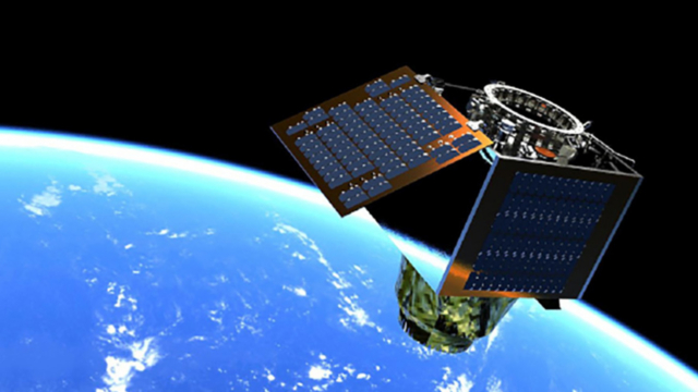
Surrey Satellite Technology (SSTL) was responsible under ESA for designing, building and operating the HydroGNSS satellites. The GNSS-R instrument was developed by SSTL, developing it from the previous design used on TechDemoSat-1 and CYGNSS missions.
A number of innovations have been introduced, including dual constellation, dual frequency, dual polarisation and the introduction of a coherent channel. SSTL works closely with science partners to process these measurements and recover the geophysical parameters.
Working with UK and European partners
The science partners, who are key elements of the entire project, include Sapienza and Tor Vergata University of Rome, Institute of Space Sciences (IEEC/ICE-CSIC), Barcelona, Finnish Meteorological Institute, Finland, IFAC-CNR, Florence, National Oceanography Centre, Southampton, University of Nottingham, UK and Technical University Vienna.
HydroGNSS uses a GNSS Reflectometry (GNSS-R) technique to take hydrological measurements around the Earth, closely linked to Essential Climate Variables (ECVs) that have been internationally defined to take the pulse of the Earth’s climate, specifically soil moisture, inundation, freeze/thaw state over permafrost, forest biomass, ocean wind speed and sea ice extent. Navigation signals are continually transmitted from GPS and Galileo satellites and these are used as a radar source to take measurements of reflections from the HydroGNSS satellites’ low Earth orbit.
Capturing coherent high-resolution imagery
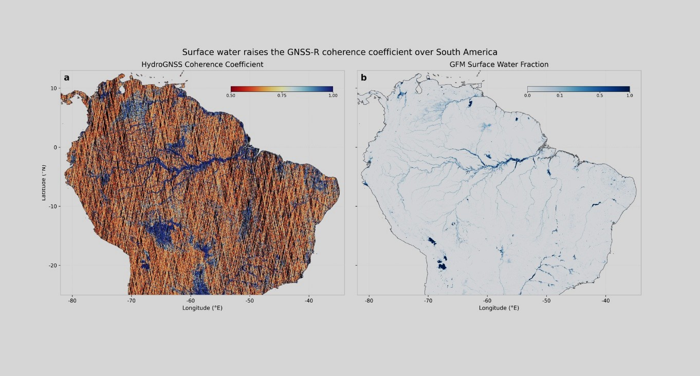
The image above – prepared by IEEC/ICE-CSIC – shows the capability of the HydroGNSS coherent channel in detecting surface water at a high resolution, even when under a vegetation canopy. On the left, coherence is detected through signal phase behaviour and is plotted over a map of South America. GNSS-R coherent channel takes forward scatter measurements in tracks, sampled at 300 metre pixel resolution, with stronger coherence found over flat surfaces, so data from both satellites are needed over a period of time to build up an image. On the right is the Global Flood Map flag generated using C-band backscatter radar on Sentinel-1, plotted over the same region.
Backscattered radar cannot detect flat surfaces under vegetation and so this shows how much more information can be recovered by GNSS-R that cannot be reached by other means. The presence or absence of water under forest canopies plays a significant role in the generation of the greenhouse gas methane but it has been difficult to quantify the extent of these wetlands until now.
Martin Unwin, Industrial Principal Investigator for the HydroGNSS mission, said: “It is fantastic to see HydroGNSS in action, generating new measurements which we hope will support hydrological science and flood preparedness, while also enabling discovery of new applications, continuing the story from TechDemoSat-1 and NASA CYGNSS missions.”
Further products from HydroGNSS will be presented in due course.
Sign up for our newsletter and get our latest content in your inbox.
Similar Reads


Sign up for our newsletter. Select all sectors relevant to you.
Related