Advancing UK Aerospace, Defence, Security & Space Solutions Worldwide
  • Home
  • /
  • Space
  • /
  • ESA awards QinetiQ a contract for ALTIUS satellite

Space

ESA awards QinetiQ a contract for ALTIUS satellite

QinetiQ’s space business has confirmed it has secured a major new €75 million contract with the European Space Agency (ESA) to extend Europe’s capabilities in operational Earth Observation, which will see the company develop and assemble the ALTIUS satellite at its new state-of-the-art cleanroom facilities in Kruibeke, in Belgium.


Courtesy QinetiQ

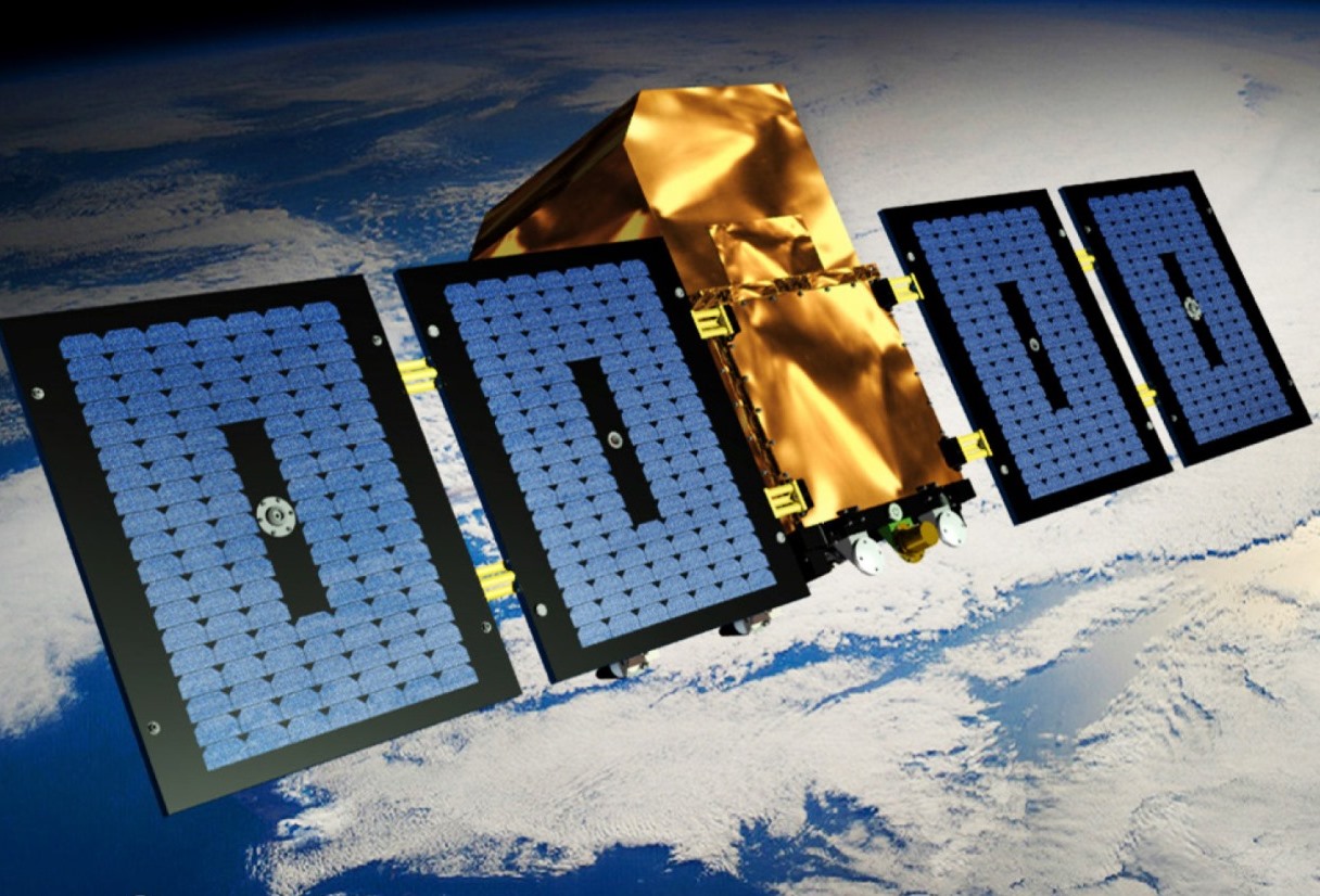
The Atmospheric Limb Tracker for Investigation of the Upcoming Stratosphere (ALTIUS) is a satellite mission that will monitor and map the distribution and evolution of stratospheric ozone at a very high vertical resolution. Due for launch from French Guyana by the end of 2023, the satellite will use advanced spectral imaging technologies to monitor the Earth’s atmospheric limb in the Near Ultraviolet, Visible, and Near Infrared spectral regions. ALTIUS is comprised under the ESA Earth Watch Programme, with the objective of developing new scientific Earth Observation satellite missions and data exploitation schemes to advance science and knowledge of the planet.

Advertisement
Leonardo RT

The ALTIUS satellite will be built on QinetiQ’s versatile P200 platform, the latest generation of the highly successful PROBA platform. It has demonstrated excellent performance on previous space missions and accumulated more than 35 years in orbit. The new satellite will also feature QinetiQ’s ADPMS-3 avionics, two deployable solar wings and a propulsion system that will allow for orbit maintenance and will deorbit at the end of its life. The mission lifetime is envisaged to be of minimum three years.

“We’re delighted to be playing such a key role on this important programme,” said Jim Graham, Managing Director of QinetiQ’s space business. “Detailed monitoring of stratospheric ozone is vital and will support both broader operational services as well as long-term trend monitoring and scientific understanding of our atmosphere to help address serious concerns about the Earth’s protective ozone layer. By also measuring greenhouse gasses, it will help to produce definitive atmospheric models to support more informed decision-making.”

Advertisement
Gulfstream RT

“Securing this significant contract is a great way to start an exciting new decade for space exploration and observation, and reflects our capabilities and experience as a prime – managing a consortium of companies from Belgium, Canada, Luxembourg, and Romania – and reliable systems integrator for delivering effective end-to-end mission solutions.”


Advertisement
PTC PTC
Airbus-built Sentinel-4 launched onboard MTG weather satellite

Space

Airbus-built Sentinel-4 launched onboard MTG weather satellite

2 July 2025

The European Space Agency (ESA) and its partners have confirmed the successful launch of the Airbus-built Sentinel-4, a cutting-edge air quality monitoring instrument hosted on the third generation Meteosat (MTG-S1) weather satellite.

Teledyne CIS120 sensors launch on GOSAT-GW

Space

Teledyne CIS120 sensors launch on GOSAT-GW

1 July 2025

Teledyne Technologies Incorporated, a provider of advanced imaging solutions, has confirmed that two CIS120 sensors designed and manufactured by Teledyne Space Imaging will play a major part in the third in a series of Japanese climate change and Earth observation satellite missions.

Expleo’s science-based climate action targets approved by SBTi

Aerospace Defence Space

Expleo’s science-based climate action targets approved by SBTi

27 June 2025

Expleo's near and long-term science-based emissions reduction targets have been validated by the Science Based Targets initiative (SBTi).

Serco launches Net Zero Standard for suppliers

Aerospace Defence Security Space

Serco launches Net Zero Standard for suppliers

25 June 2025

Serco has today launched a new Net Zero Standard for its suppliers, demonstrating its commitment to sustainable procurement and to partnering with its suppliers to reach Net Zero emissions by 2050 or sooner.

Advertisement
Teledyne
Five projects to use satellite data to drive public services

Space

Five projects to use satellite data to drive public services

24 June 2025

Five projects from across the UK will use satellite data to help transform the delivery of public services, thanks to new funding from the UK Space Agency.

CGI to deliver core ground segment for ESA

Space

CGI to deliver core ground segment for ESA's TRUTHS satellite mission

24 June 2025

CGI as been selected as the provider of the Payload Data Ground Segment (PDGS) for the European Space Agency’s (ESA) TRUTHS mission, a pioneering Earth Observation satellite designed to enhance global climate monitoring and enable cross-calibration of EO missions.

Advertisement
Teledyne