Gatwick creates geospatial platform with GIS from Esri UK
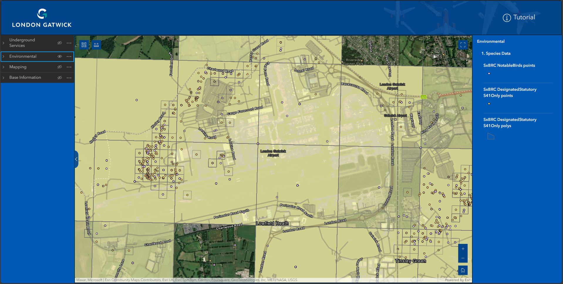
Image courtesy Esri UK
The system is already making engineering and construction works safer by reducing accidental strikes on buried utilities and enabling better management of the airports biodiversity.
The geospatial platform contains critical infrastructure information spanning the 70-year history of the airport, including BIM, CAD, utilities, environmental, aerial photography and legacy data. By integrating all spatial data into a single view, combined with advanced spatial analysis tools, mobile apps and dashboards, the Esri platform provides new insights to support better collaboration and decision-making across the airport. London Gatwick selected GIS from Esri UK following a competitive tender.

The single view of buried assets including gas, electricity, telecoms, water and fuel, is proving critical in reducing accidental damage to utilities across the 1,600-acre site. Field engineers, third party contractors and major consulting firms all use the same single view of data, accessible on any device, when planning excavations. With up to 50 engineering and construction projects on site at any one time, the new system is making work safer and reducing risk of disruption to airport operations from any unplanned outages.
London Gatwick is using the geospatial platform to support its award-winning Biodiversity Action Plan, designed to deliver a biodiversity net gain at the airport by 2030. Within the airport boundaries are 75 hectares of woodlands, grasslands and wetlands, inhabited by hundreds of species of mammals, birds, insects and bees. Environmental data in the GIS includes environmental stewardship areas, notable birds, protected, rare or invasive alien species and bat box locations. The system also visualises the estimated embodied carbon of built assets.
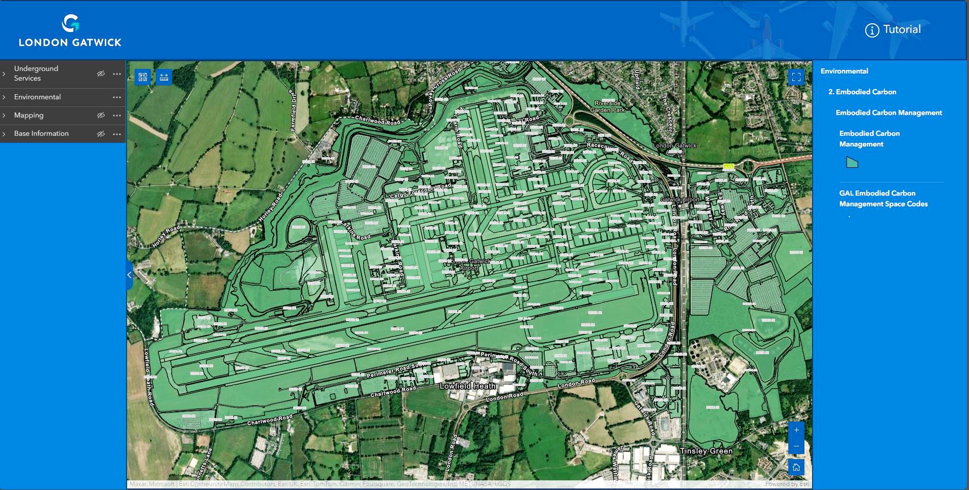
Insights from the GIS allow Gatwick to plan works around any environmentally sensitive sites to minimise impact and seek ways to bring additional benefits, such as improving biodiversity. The embodied carbon data allows users to see the carbon ‘price’ of assets, supporting sustainability decisions by showing the potential carbon emissions of demolitions or new construction.
“Being able to visualise and interrogate all spatial data from any discipline, on any device, is critical to the sustainable future of London Gatwick. Democratising spatial data in this way drives significantly more business and operational value from it,” explained Simon Richardson, Digital Information Lead, London Gatwick Airport. “The new GIS supports our Master Plan, which includes delivering efficiencies through new technologies and process improvements, while bringing passenger service benefits and protecting the environment we operate in. It provides an immediate understanding of operational infrastructure, supporting faster and more informed decisions, which are integral to the running of the airport.”
Previously, Gatwick used Autodesk’s Infrastructure Map Server to manage spatial data but looked for another GIS software vendor when the product became unsupported. “We selected GIS from Esri UK because its Managed Cloud Service made it more accessible at lower cost than an on-premise approach,” continued Richardson. “It also removes the burden of system management and updates, which saves a significant amount of time, allowing more resource to focus on strategic projects. The new system is quicker and easier to use and the benefits far outweigh the cost.”
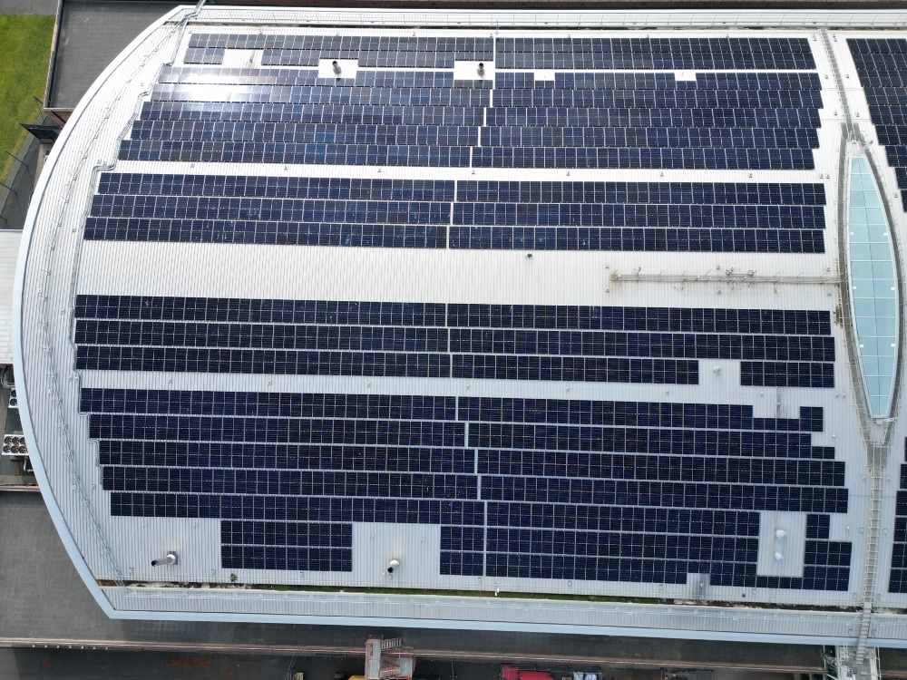
Future plans include using the geospatial system as a planning tool for estate-wide works, including runway maintenance and repairs and making the data available to local planning authorities bordering the airport to help streamline their planning process. The airport’s sustainability strategy is also set to benefit from the GIS, by helping to determine the optimal sites for solar panels, from potentially floating them in lakes or installing them on the most effective roof tops. Gatwick’s ‘Decade of Change’ roadmap includes sourcing 50% of airport electricity from renewable sources with onsite generation part of the mix.
“Requests for new types of online maps are coming from across the business on a daily basis so the system is growing all the time. We expect the geospatial platform to grow significantly within the next 12 months,” said Richardson. “The Esri GIS has given us the foundation to create a digital twin. As a complex site with over 70 years of history, we are building a virtual representation of what has previously been built along with future plans, which helps manage the airport’s development.”