Hypervine launches unlimited satellite survey service for mining industry
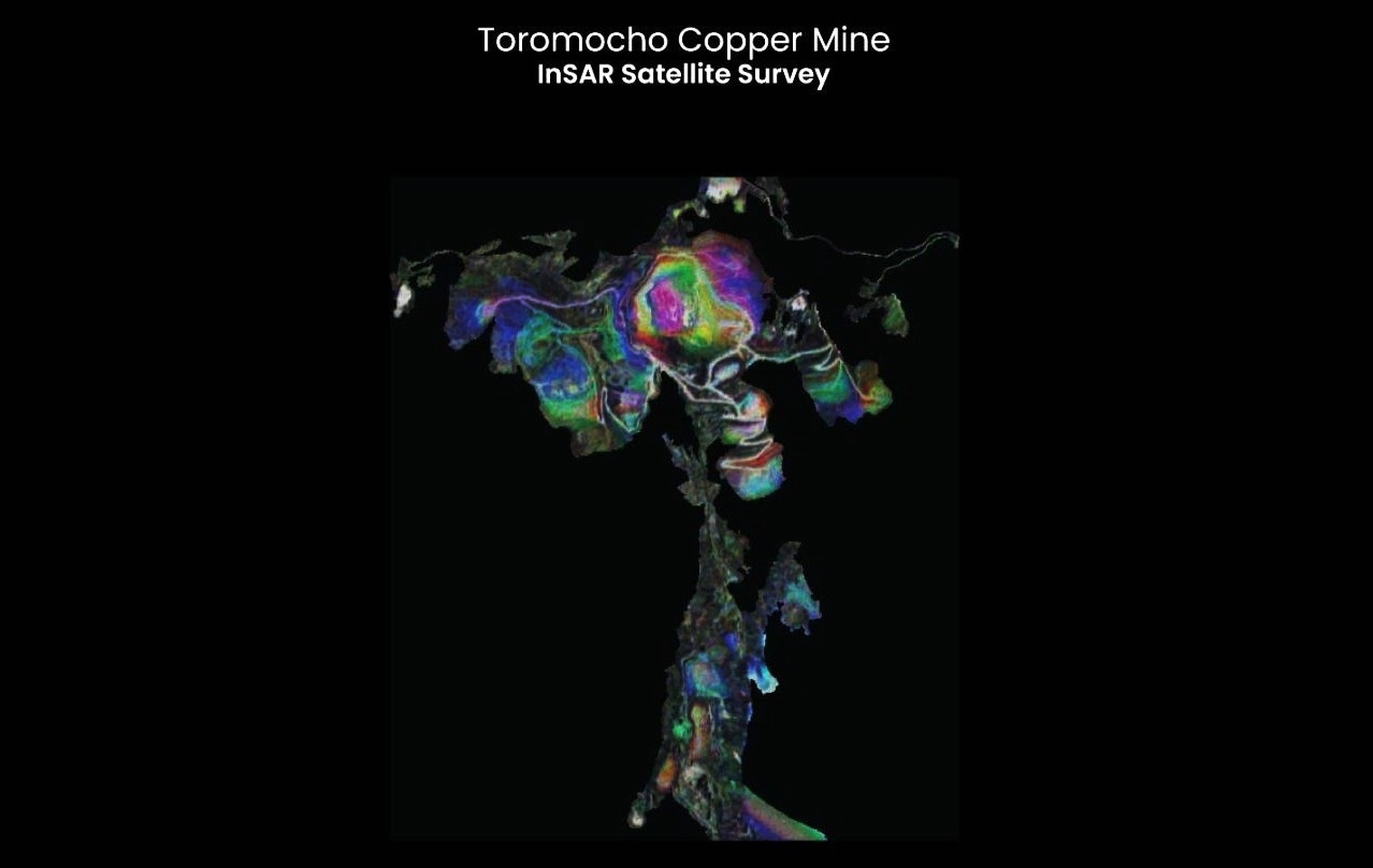
Image courtesy Hypervine
This approach is executed through a fixed monthly fee of £4,750, compared to the industry standards where one report per mine will cost upwards of £5,000 each. Hypervine’s offering promises to shake up numerous industries by providing cost-effective, accurate and comprehensive global data on precise mineral mapping, open pit mines and even some below ground activities, organic material monitoring and more. Hypervine’s surveys can offer an alternative to existing reports with satellite-sourced imagery and data at a fraction of the cost of existing offerings, without the costly need of having people on-site at the mines themselves.

Hypervine builds on its partnership with the European Space Agency (ESA) to create the satellite surveys. It utilises advanced imaging and analytics to monitor mine activities, track changes in infrastructure, and assess environmental conditions, offering unparalleled insights into mine operations, environmental impact and resource management for prospectors, investors, mining firms, insurers or more. The service, which leverages and builds on Hypervine’s extensive database, one of the largest and most accurate collections of base metal datasets globally, includes detailed reports on ferrous metal content, land surface temperature changes, and vegetation indexes, among other key indicators.
These reports are invaluable for companies looking to invest in or monitor mining operations and need to extract insights from large volumes of data without being experts in data processing techniques, while providing a level of detail previously impossible without physical site visits. This kind of access to satellite data is not only more affordable than traditional survey methods but also provides medium to large companies with critical data to make informed decisions, far faster than traditional methods of data gathering on-site.
Paul Duddy, CEO of Hypervine, stated, "Our unlimited satellite survey service is a game-changer for investors and the mining industry. By offering detailed, accurate, and timely data at a fixed monthly cost, we are opening up new possibilities for how assets are monitored, managed and invested in. This service is a testament to our commitment to innovation and our belief in the power of satellite technology to drive data-backed decision making."
Hypervine satellite surveys can be used for due diligence before traditional ‘on the ground due diligence’, monitoring commodity patterns, including production, activity, and environmental analysis. Satellite surveys may help prevent or identify early disasters such as the Brumadinho Disaster and the 2020 Hpakant jade mine disaster. If such an eventuality does occur, this technology can massively support the mitigation of compounding adverse effects.
Hypervine’s service simplifies and reveals information previously inaccessible due to the complex nature of processing satellite data and the expense of it. Stakeholders and investors in a mine’s output will have a clearer understanding of what is happening with the mine, concentrating on the outputs and their implications for their work, rather than getting bogged down in the technical aspects of data processing and able to prepare for any potentialities. They will also be able to compare mines directly thanks to the standardised reporting satellite data offers.
The introduction of this service and its series of free monthly reports comes at a time when the demand for base metals, such as copper, bauxite, and iron, is surging due to their critical role in battery production and the broader transition to renewable energy sources. Hypervine's offering is perfectly positioned to support this growing need, providing valuable data to investors, environmental groups, data companies and the mining companies themselves.
Hypervine's service is designed to be highly accessible, catering to the needs of a wide range of stakeholders, whether it is for due diligence, environmental monitoring, insurance, or investment analysis.