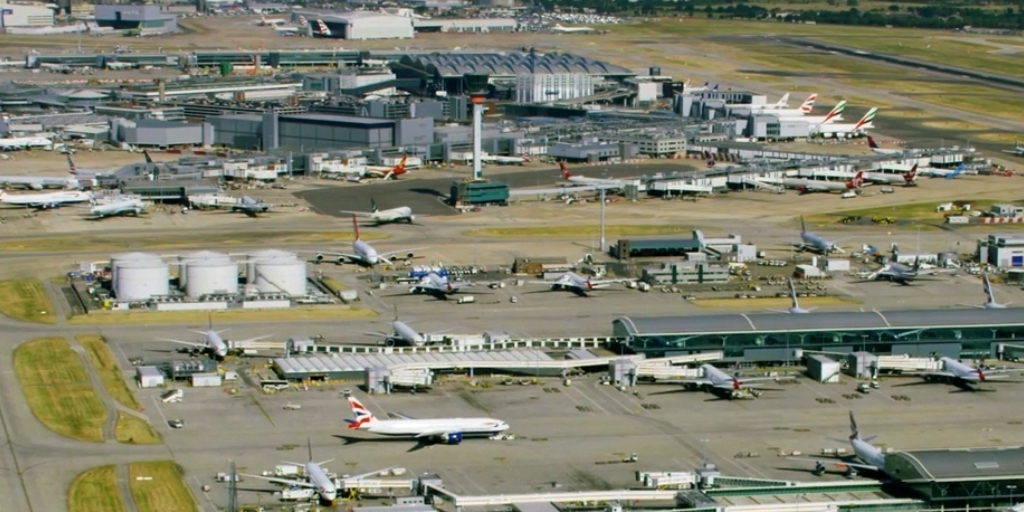
OS extends DEA Aviation contract
Image courtesy OS
Over the past seven years, DEA has consistently delivered the annual requirement to provide aircraft, pilots and ground facilities to support the capture of high quality images used in the OS National Geographic Database (NGD). This year, following a highly successful flying season, OS has decided to extend the contract with DEA through 2026.

With the support of DEA, OS captured over 80,000 square kilometres of GB despite contending with a more restrictive airspace as commercial air transport rose across the year.
Alongside this year-on-year rise in air traffic of three per cent (CAA), compared to the same period in 2024, aerial mappers must contend with unpredictable weather patterns as unfavourable conditions such as rain or cloud cover renders images unusable. For OS’s National Cyclic Revision capture programme to work as intended, blocks of image data are captured at different intervals throughout the year and pieced together seamlessly to enable the update of the OS NGD.
DEA is a key supplier to OS, supporting the collection of high-resolution aerial imagery of GB. These images, collected through aerial mapping, are part of the process to authoritatively describe and depict changes to the geography of GB.
This framework supports the need for pilots, engineers and technicians, sustaining job creation and skill retention throughout the contract’s active period.
Paul Evans, Senior Business Manager at DEA said: “Extending our contract with Ordnance Survey through 2026 is a testament to the successes of the past six years and exemplifies the importance of the collaboration.
“This authoritative data underpins the Ordnance Survey National Geographic Database and supports critical use cases from emergency planning to infrastructure and urban development. We’re proud to be one of OS’s key suppliers and to continue investing in skilled pilots, engineers and technicians, who support this national mapping capability.”
Paul Cruddace, Head of Production at Ordnance Survey, said: “The work of the Ordnance Survey Flying Unit is an absolutely crucial element of how we maintain the digital master map of Great Britain, flying the entirety of the country every three years. DEA has delivered a great service to our Flying Unit and we are very pleased to be extending our contract with them.”