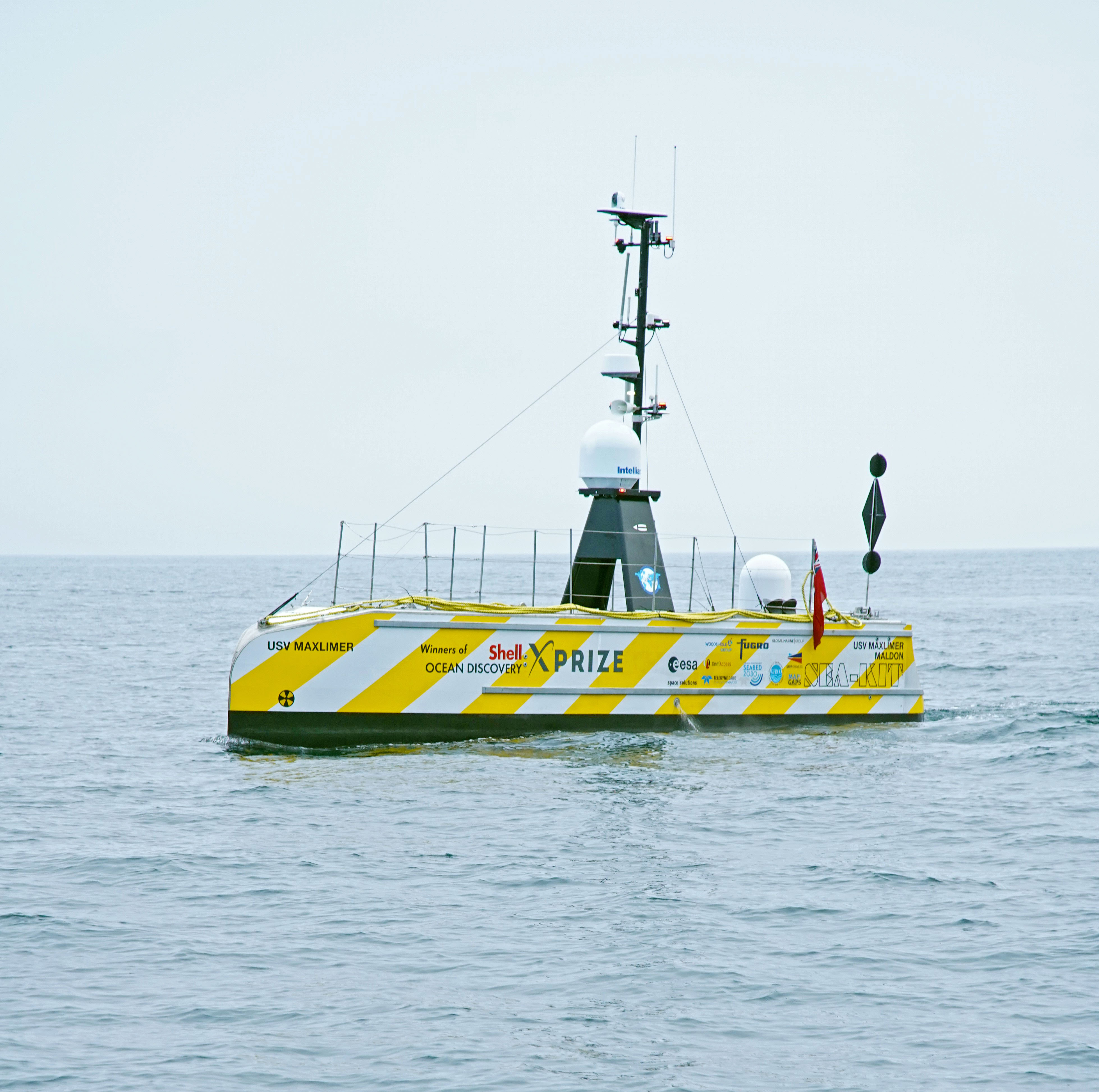
SEA-KIT USV completes satellite controlled Atlantic Ocean ops
Above:
The uncrewed vessel returned to Plymouth with its fuel tank still around a third full.
Courtesy SEA-KIT / photo Rich Edwards, ENP Media
The successful completion of this project is a major achievement for the British SME, clearly demonstrating the capabilities of their remotely-controlled USV design in terms of over-the-horizon operation, endurance and ocean-going ability.

“This proof of concept is exciting and confirms Fugro made the right choice to partner with SEA-KIT to develop a range of USVs that will transform the marine industry,” said Ivar de Josselin de Jong, Director Remote Inspection at Fugro. “We are on track with our strategy of leading the development of remote and autonomous solutions.”
Peter Walker, Director of Technology at SEA-KIT, expressed delight at welcoming Maxlimer back to Plymouth: “It has been a tense but exciting few weeks. The project’s overall aim was to demonstrate the capabilities of current technologies to survey unexplored or inadequately surveyed ocean frontiers and we have absolutely done that. It is a groundbreaking achievement to prove true over-the-horizon capability and the team are elated to have successfully pushed the boundaries of our USV design once again.”
Named UTAS (Uncrewed Trans-Atlantic Survey) and co-funded by the UK Space Agency through the European Space Agency’s Business Application programme, the project was originally planned to be trans-ocean. However, due to travel restrictions and other planning complications resulting from COVID-19, this was ultimately not possible.
SEA-KIT worked collaboratively with a number of industry partners on the UTAS project. Fugro, Global Marine Group, Map the Gaps, Teledyne CARIS, Woods Hole Group and The Nippon Foundation-GEBCO Seabed 2030 project all played a part in its successful completion.
“The data gathered on this Atlantic voyage will be a valuable addition to the global seabed,” said Jamie McMichael-Phillips, Director of Seabed 2030. “More importantly, this is another milestone on the journey towards the development of the kind of scalable, environmentally-friendly technology that we are going to need in order to reach our goal of mapping the whole of the world's ocean floors by the end of the decade.”
McMichael-Phillips continued: “We are immensely proud of the SEA-KIT team and of what they have achieved in being able to operate an uncrewed vessel over the horizon. What began as a scientific challenge taken on by the talented members of the GEBCO-Nippon Foundation Alumni team became an award-winning technology that has now matured into a viable commercial company. This is exactly the kind of innovative ecosystem that GEBCO and The Nippon Foundation were trying to create when they launched Seabed 2030.”
The Nippon Foundation/GEBCO Alumni through Map the Gaps, with their global distribution, allowed for 24 hour bathymetric surveying as they remotely operated the multibeam and ensured optimised data acquisition.
Travis Hamilton, Product Manager at Teledyne CARIS said: “At Teledyne CARIS, we are inspired by projects that align with our passion for innovation in hydrographic survey. We were pleased to support this project with our automated hydrographic processing solutions CARIS Onboard and CARIS Mira AI that apply workflows designed to remotely support the unique challenges of uncrewed surveys from shore-based stations.”
The proven ability to conduct remote survey operations with USVs has many beneficial applications across the offshore sector. For example, critical tasks such as trans-ocean cable route surveys, needed to meet the increase in demand for data communications, can be completed without risk to personnel and with significant savings on mobilisation and operational costs when compared to executing the same task with crewed vessels.
UK Space Agency Chief Executive, Graham Turnock, summed up how USVs are set to redefine offshore operations: “On its 22-day mission the Maxlimer vessel used satellites in the sky to show us what we can do under the sea. Robot boats could radically change the way we work at sea and this project, backed by the UK Space Agency, has given us a unique window into the future potential of satellite-enabled maritime operations.”