Sentinel-1D satellite launched

Copyright Airbus
With the successful launch of the European Space Agency (ESA) Sentinel-1D satellite, the Airbus-built Synthetic Aperture Radar (SAR) onboard joins its siblings Sentinel-1A and Sentinel-1C, guaranteeing radar acquisition and continuity worldwide with a planned lifetime of more than seven years in orbit. Sentinel-1A was already launched in 2014 and is at the end of its lifetime and Sentinel-1C was successfully launched last December 2024.

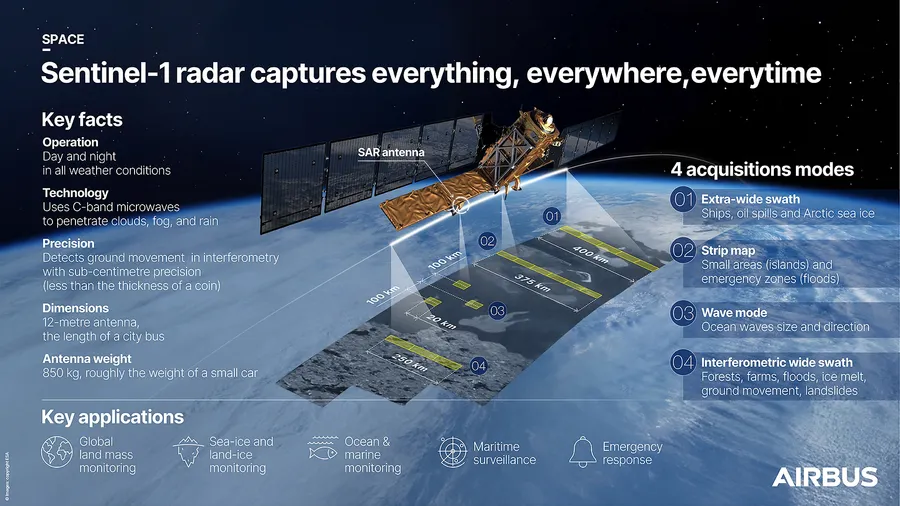
Deployed under the European Copernicus programme, Sentinel-1D will carry out monitoring activities of missions supporting global land masses, sea- and land-ice and the ocean together with emergency response.
Sentinel-1 is a global monitoring mission, providing imagery of the Earth's surface and oceans, monitoring sea ice zones, providing surveillance for marine environments and mapping in support of humanitarian aid in crisis situations. The system comprises two satellites orbiting 180 degrees apart, enabling images of the entire Earth to be produced every six days.

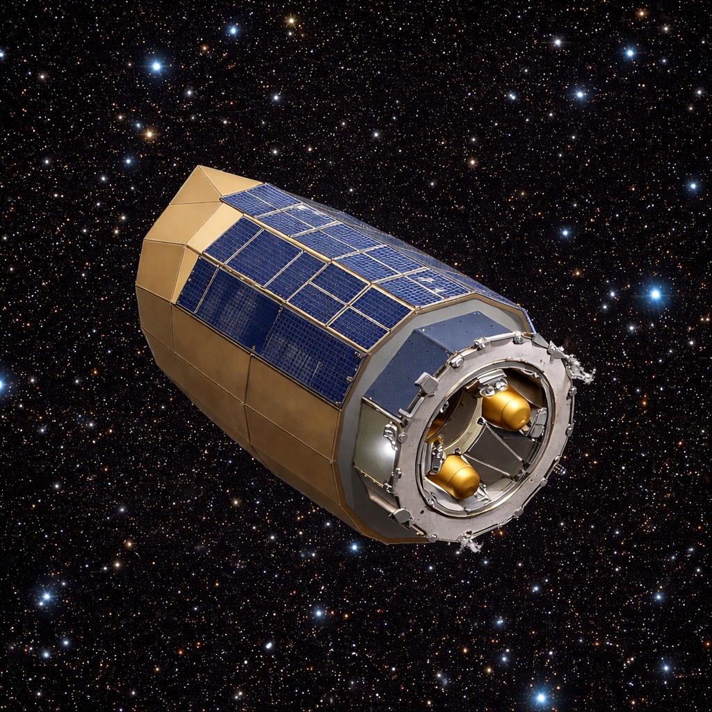
Above: Sentinel-1 has been designed and built by a consortium of around 60 companies led by Thales Alenia Space.
Copyright Airbus
Airbus designed and manufactured all C-band synthetic aperture radars (SARs) for the Sentinel-1 fleet in Friedrichshafen, Germany, with the electronic subsystem manufactured in Portsmouth, UK. The 12-metre long radar provides all-weather, day and night imaging of the Earth's surface.
This is the fourth and final satellite in the Sentinel-1 programme with Sentinel-1A having been launched in 2014 and Sentinel-1D launching over a decade later. The launch of this satellite will ensure continuous, high-quality radar images of the entire Earth with accuracy of up to a few millimetres.
SAR technology in previous Sentinel-1 satellites has been fundamental in examining our planet. For example, in 2021 it tracked an enormous iceberg, which was larger than the Spanish island of Majorca, after it broke off Antarctica's Ice Shelf.
Additionally, Sentinel-1 radar images provided information on an earthquake which struck central Myanmar, sending shockwaves through the region. The SAR data enabled the creation of a detailed view of how the ground shifted as a result of the earthquake.