SSTL celebrates 20th Anniversary of CHRIS Hyperspectral Imager
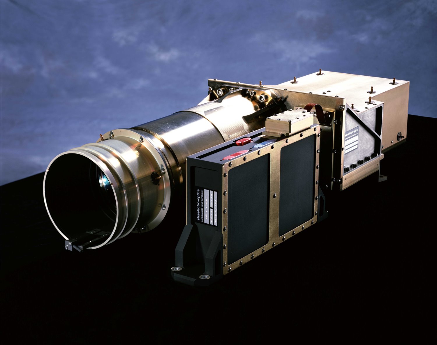
Image courtesy SSTL
PROBA-1, a micro-satellite less than one cubic metre in size, was launched into a low earth orbit of 615km on 22 October 2001, and the satellite is still in operation today. The CHRIS imager on board the satellite weighs only 14kg and was designed by engineers from the Space Group of Sira Electro-Optics, which was acquired by SSTL in 2006: a number of engineers who designed and worked on the original imager are still employed at SSTL today.

Initially launched as a technology demonstration mission, PROBA-1’s design was highly innovative and the satellite platform and CHRIS payload effectively work as one to image the Earth. Using a star tracker for guidance, the satellite can roll off to ±25º off-nadir in the cross-track direction and ±55º in its along-track. This tracking ability allows PROBA-1 to compensate for the effective satellite groundtrack speed and this ‘forward motion compensation’ boosts its overall integration time per image, giving CHRIS an imaging performance and signal-to-noise equivalent to that of an instrument with an aperture area five times larger.
This agility means that CHRIS can also view the same target from five directions, a unique feature of the mission and instrument and this capacity in particular that has proved invaluable to many scientists investigating the BRDF (Bi-Reflectance Distribution Function) of vegetation and other land cover features – meaning how the light they reflect changes with shifts in illumination or view angle. The wavelength and bandwidth of each spectral band is fully programmable, and 18 spectral bands can be selected in each image. This can be increased to 62 bands per image at a lower spatial resolution.
The CHRIS imager records fine detail features of environmental and climatological interest on the Earth surface. Utilisation of the data has been extensive over the last 20 years and continues daily at a high level with 219 sites imaged in 2021. Data has been provided to scientists in 25 countries covering every continent, a total of 945 unique sites.
The scientific community uses the data to derive improved measures of a range of physical, chemical and biological properties that describe the `health' of our planet. This includes information on the albedo of the land surface (a critical parameter in climate models), plant biomass and chlorophyll content (vital information for precision farming), and the organic matter content in inland and coastal water bodies (to monitor, for example, so-called `red tides'). Other applications have included the identification of potential avalanche sites and oil spills and a novel technique of mapping underwater features, such as coastal reefs via analysis of wave motion.
The CHRIS imager’s field of view is 13.5 x 13.5 km, and the spatial resolution is 17 m. The imager operates over a wavelength range of 400 to 1050 nm, and the spectral resolution varies between 1.5 nm in the blue and 11 nm in the red.
A worldwide community of users have based their research on data from CHRIS and the following list represents a few examples of applications:
• Teams in Switzerland, Germany and Australia have used CHRIS observations to classify the leaf angle and therefore maturity of maize, wheat and cotton crops respectively. CHRIS data tracks the angle of the leaves which increases as the crop grows and the heads dominate.
• A team at the University of Kaiserslautern in Germany has employed CHRIS imagery to measure the coverage and estimate the biomass of lichens and biological soil crusts in the Namibian Desert. These crusts play an important ecological role, anchoring soil in place, so their loss over time can flag up erosion patterns.
• A community of users are using CHRIS data to sample water quality, using multispectral data to derive standardised parameters such as chlorophyll content, total suspended soils and dissolved organic matter within inland water bodies.
• A team at the University of New South Wales in Australia has developed an innovative algorithm to estimate the shallowness of coastal waters by identifying the shifting frequency of waves as they approach the coast or underlying reefs, employing the fact that the wave’s spatial frequency increases as the water gets shallower. This technique can be used in highly sedimented water without needing to rely on the optical visibility through the water as typically used in bathymetry.
PROBA-1 also flies an SSTL GPS receiver that provides crucial positional information for accurate image targeting.