Viasat proves UK SBAS accuracy
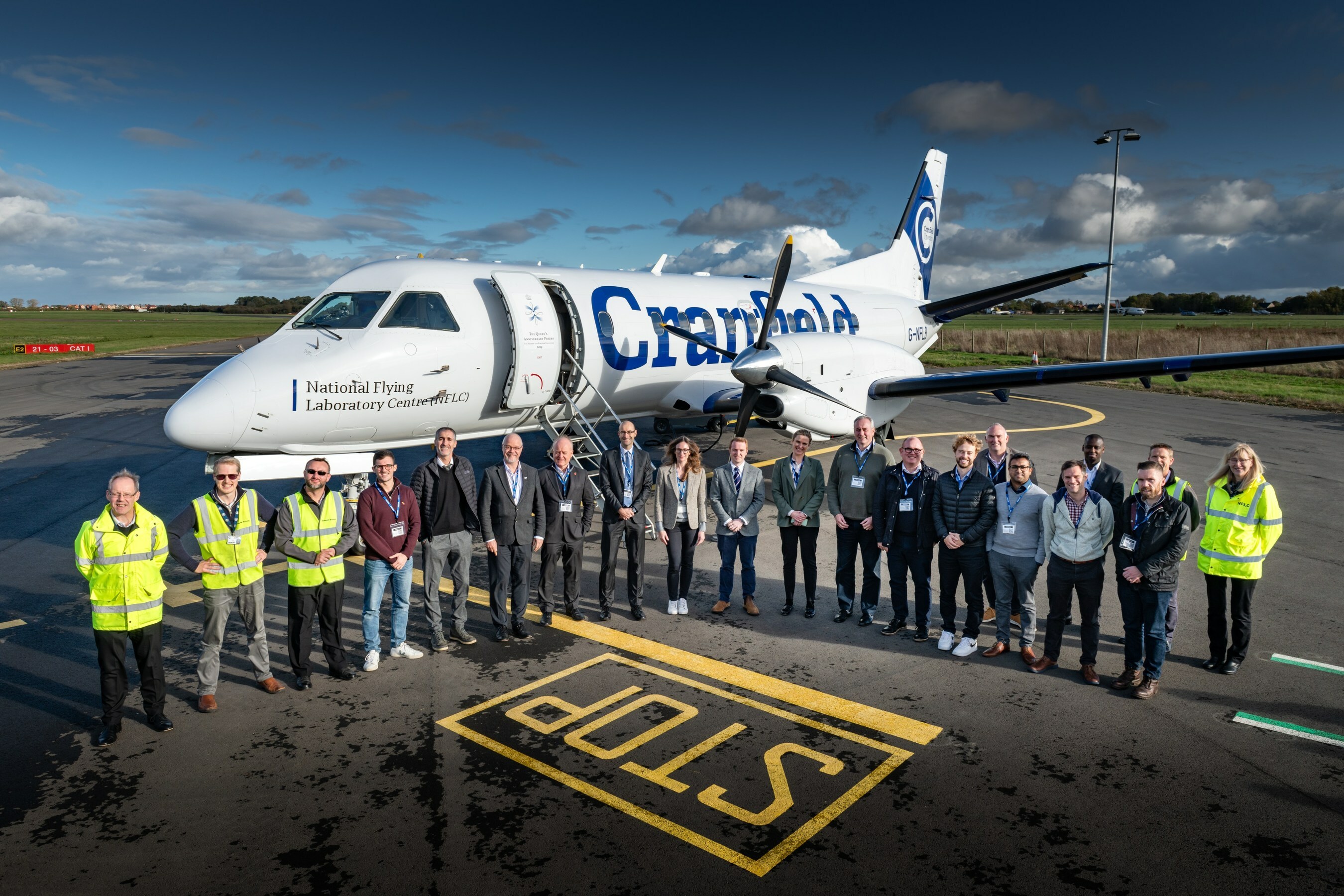
Above: Representatives from the organisations involved in the UK sovereign Satellite Based Augmentation System (UK SBAS), next to the test aircraft.
Courtesy Viasat / Cranfield University
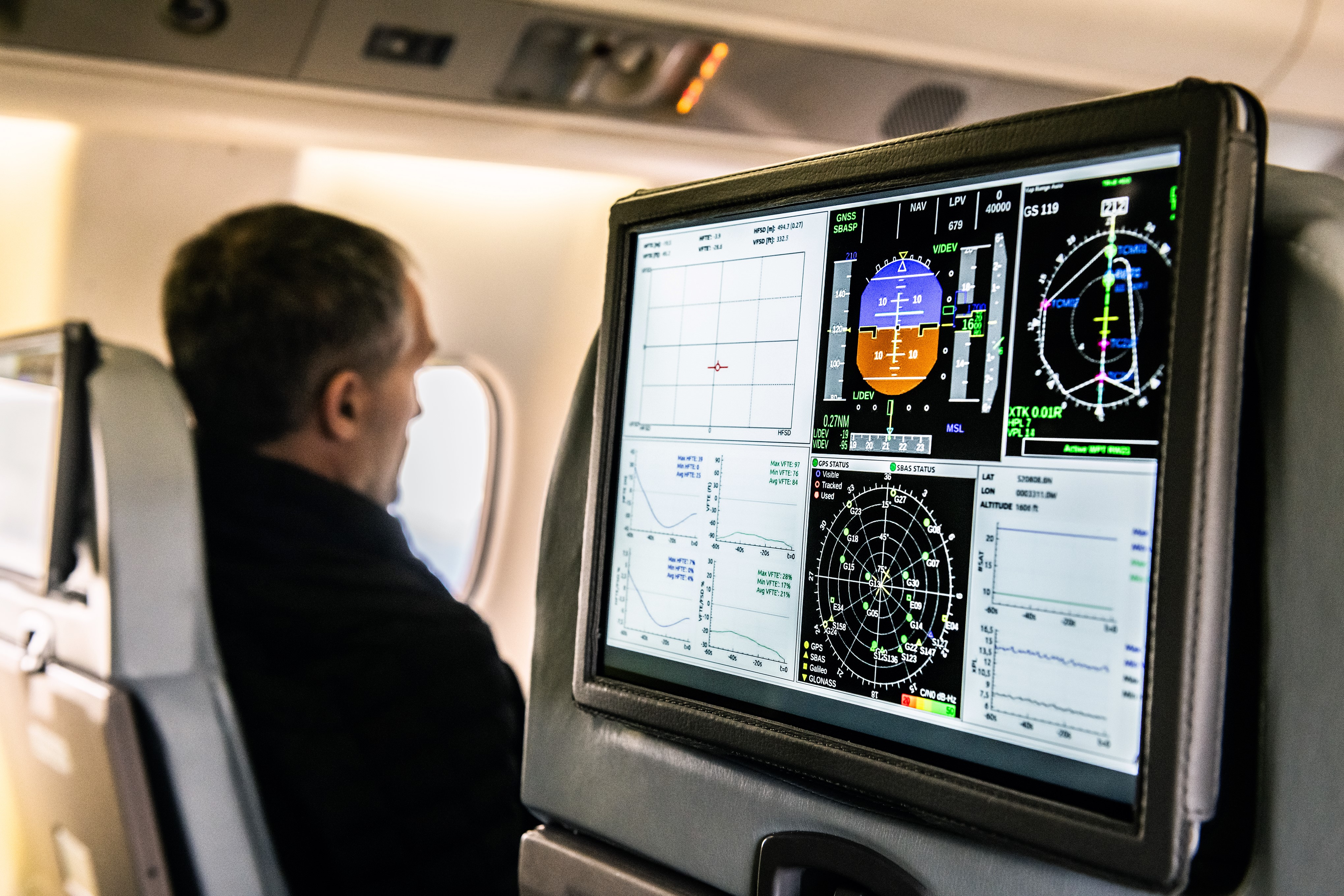
Viasat has demonstrated a UK Satellite Based Augmentation System (UK SBAS) for the first time, showing how highly accurate GPS data can maximise safety and improve efficiency. The test flight, flown from Cranfield Airport using the National Flying Laboratory Centre’s Saab 340B aircraft, showcased a UK-based SBAS that delivers more precise, reliable navigation data.

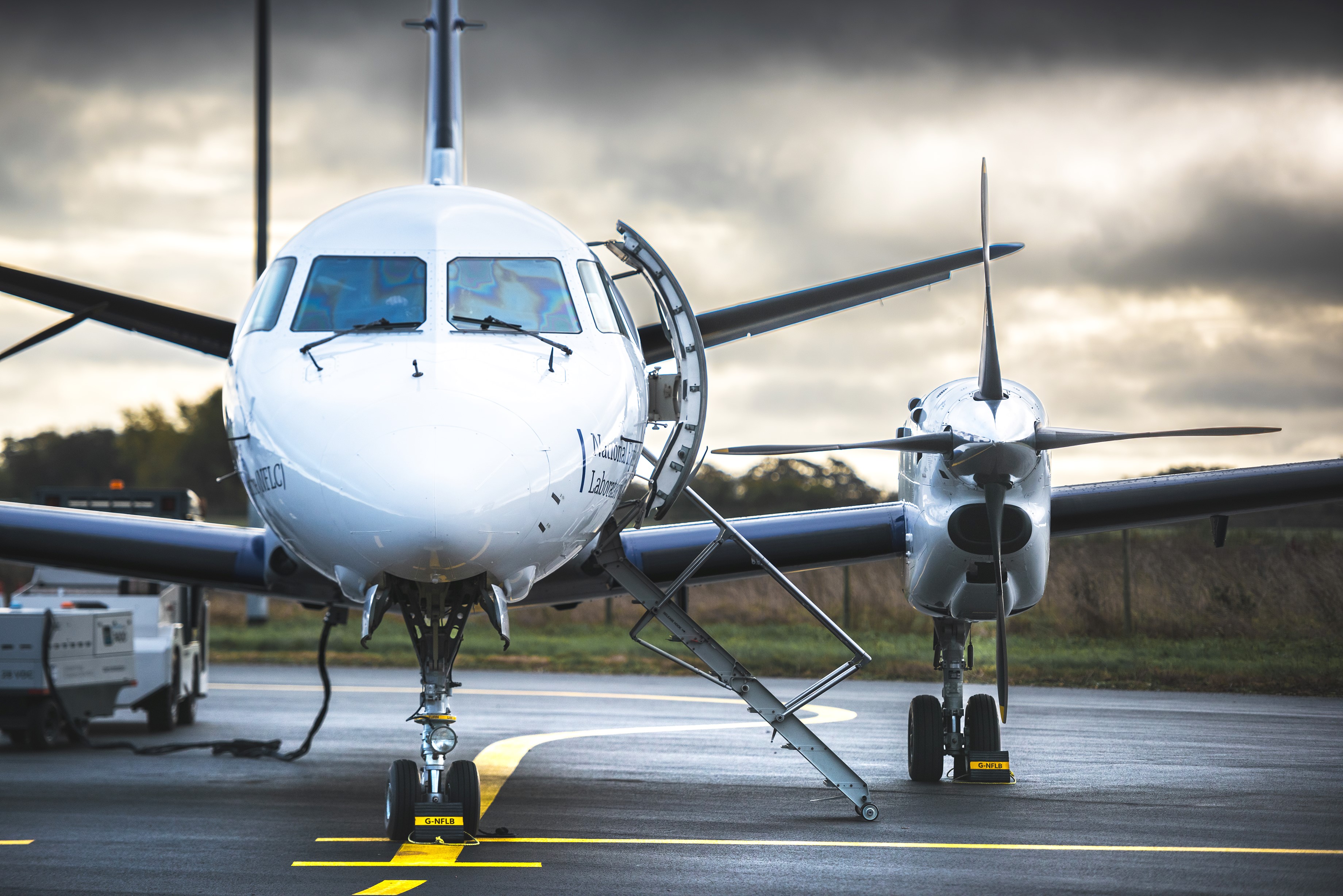
Above: Cranfield University's NFLC Saab 340B aircraft.
Courtesy Viasat / Cranfield University
The UK is no longer part of the EU’s similar European Geostationary Navigation Overlay Service (EGNOS), following its exit from the European Union. While EGNOS can still be used for non-safety applications in the UK, the trial aims to provide a first step toward a complementary UK SBAS which can be used for critical safety of life navigation services across air, land and sea.

UK SBAS works by combining ground monitoring data with satellite connectivity to provide more reliable navigational data. Across a range of applications, it can offer positioning down to a few centimetres of accuracy, rather than the few metres provided by standard GPS.
For aviation, the system gives pilots greater trust in their onboard instruments, which has major implications when pilots may not be able to physically see a runway or other obstacles due to bad weather.
This means improved safety and fewer missed landings because pilots – especially smaller aircraft flying into regional airports and general aviation airfields – can get significantly closer to the ground during an approach before making the decision whether to land. Viasat’s research with one regional flight operator indicated that close to 40% of flights cancelled due to weather could have gone ahead had UK SBAS been available for its fleet.
Around the UK, 19 airports had EGNOS procedures in place prior to leaving the European Union. In total, as many as 72 airports no longer have access.
With the aviation test complete, the trial is aimed to test the system in other transport applications, for example for rail, uncrewed aerial vehicles, or autonomous road vehicles.
Technology Minister at the Department for Transport, Anthony Browne said: “This successful demonstration illustrates the UK’s first-class space sector, and our capabilities in position, navigation and timing specifically.”
“The project, fully funded by Government through the ESA NAVISP programme, is directly supporting our work on future provision of high-accuracy, high-integrity positioning services, which could increase efficiency and enable new innovations across the transport network.”
Todd McDonnell, President, International Government, Viasat, said “This trial on a sovereign UK SBAS is all about delivering trust. Trust for pilots in their tracking systems so they can stay safe in challenging conditions. Trust for the aviation industry more broadly so it can rely on data to operate more efficiently. And, in the future, trust that we can use highly accurate tracking to develop Britain’s transport system as new technologies come into play. We’re excited to continue the trial and see how far we can take it.”
Dean Thomas, Position, Navigation and Timing Lead at the UK Space Agency, said: “This testbed project is vital in helping Government understand the potential benefits of a UK SBAS.
"The flight trial both demonstrates the capability of UK industry in delivering space based PNT solutions and illustrates the benefits of delivering UK PNT projects facilitated by ESA, through the highly flexible NAVISP programme.”