Cranfield researches radar drones for soil moisture monitoring
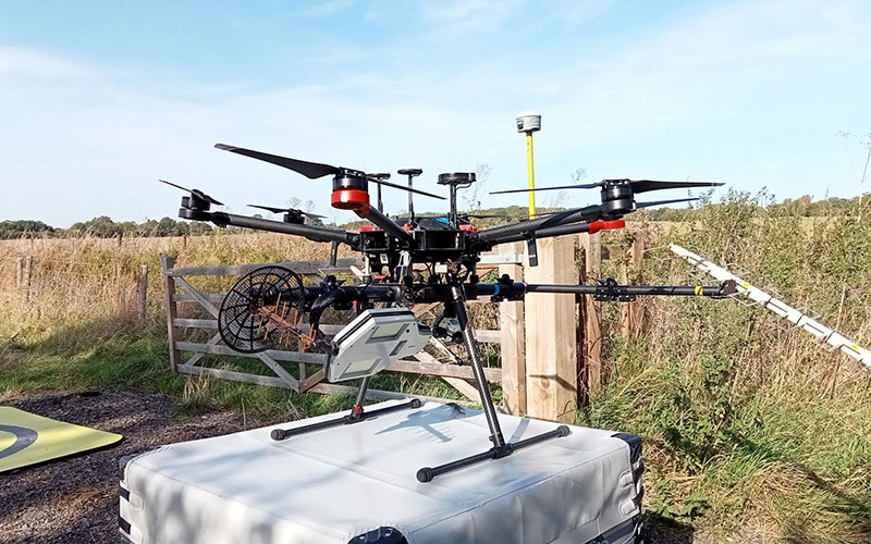
Above: Drone-based multi-band synthetic aperture radar.
Courtesy Dr Dan Evans / Cranfield University
Synthetic Aperture Radar (SAR) uses radio waves to make detailed images of the Earth's surface. It bounces waves off objects, measures their return time and combines the data to create a high-resolution map. The project, led by Dr Dan Evans, will assess the accuracy and potential applications of the innovative technology in soil moisture monitoring.

By obtaining detailed measurements of soil moisture at the field scale, the project seeks to improve flood and drought risk management, aiding farmers in making informed irrigation decisions and planning for extreme weather events. The technology could also find applications in testing the stability of railway embankments.
The project also aims to identify the effectiveness of radar-based soil moisture measurements across different land use contexts, including grasslands, arable farmlands and woodlands.
In addition to Cranfield University, the collaboration includes Surveyar Ltd and other academic partners, with funding of £30,000 from the Douglas Bomford Trust.
Simplifying soil moisture measurements with radar-equipped drones
Traditional soil moisture measurements are often labour-intensive, time-consuming and costly. In contrast, the radar-equipped drones provide continuous, cost-effective measurements of soil moisture up to 40 centimetres deep, a critical depth for plant growth and yield. While preliminary findings suggest that UAV-based radar is effective at assessing soil moisture, the project will investigate the impact that above-ground vegetation has on the accuracy of these moisture data across different land use contexts.
Cranfield University, along with partner institutions including the University of Stirling and the University of Missouri, will compare the UAV-based radar data with conventional ground-based measurements to validate the accuracy of UAV radar in comparison to existing methods. If successful, the technology could be expanded for applications such as biomass mapping and yield measurements.
Dr Dan Evans, Lecturer in Soil Formation at Cranfield University, said the project would seek to push the boundaries of radar technology by harnessing the power of UAVs: “Through mounting synthetic aperture radar onto drones, we can conduct comprehensive radar surveys of fields, providing us with detailed measurements of soil moisture. This has significant implications for managing flooding and drought risks. With increasingly warm summers and the threat of extreme weather events, monitoring soil moisture becomes crucial for optimising irrigation practices and mitigating the impact of flooding.
“Our goal is to validate the accuracy of UAV radar in comparison to traditional methods, paving the way for scalable and cost-effective soil moisture monitoring solutions.
“This technology has immense potential not only for agriculture but also for environmental monitoring, biomass mapping and yield measurement.”