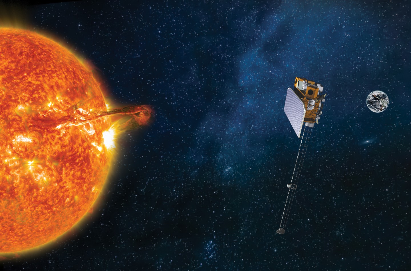
Space data helping Earth adapt to climate change challenges
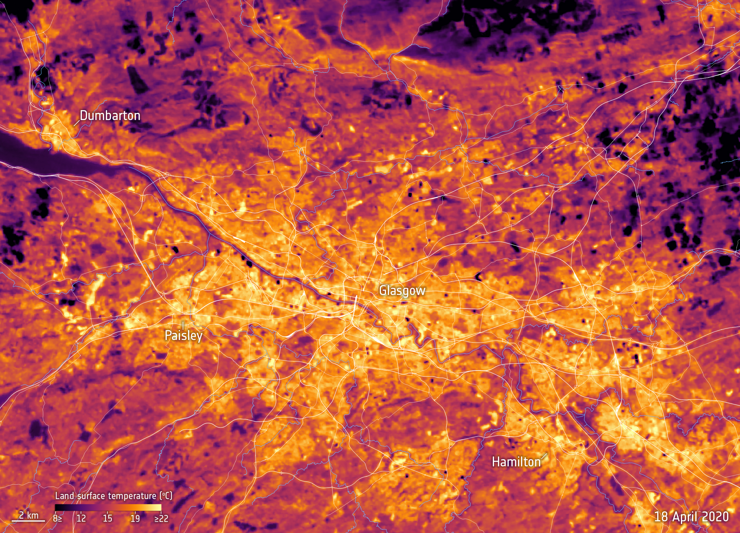
Above:
Satellite images showing Glasgow land surface temperature.
Courtesy UKSA / Credit: ESA, NCEO, University of Leicester
The first project is a collaboration between the National Centre for Earth Observation (NCEO) and Ordnance Survey (OS), which will provide meaningful insights for policy-makers to manage the impacts of climate change in hot spots across the UK and beyond.
Using NCEO land surface temperature data derived from thermal infra-red sensors in space, OS will then help customers understand and identify how the data can be applied effectively.

The UK Space Agency is also supporting a prototype Climate Risk Index tool that delivers risk assessments based on satellite and climate data to help the insurance sector provide vital financial products to those at risk from droughts and wildfires.
Both schemes have been unveiled ahead of British ESA astronaut Tim Peake’s attendance at COP26, the United Nations climate change conference being hosted by the UK in Glasgow. Tim will be visiting the Space4Climate stand where he will answer questions from young people and talk about how space is helping to monitor and tackle climate change.
Beth Greenaway, Head of Earth Observation and Climate at the UK Space Agency, said: “The UK is leading the way in using space to monitor, understand and tackle climate change.
“Both of these new projects will provide decision-makers with vital information to help deal with the effects of climate change and improve lives around the world.”
The latest UK climate projections show a hot summer like 2018 is likely to occur every other year by 2050, by which time the number of heat-related deaths could more than triple from today’s level in the absence of additional adaptation; from around 2,000 per year to around 7,000.
As many as 1.2 billion people around the world could face heat stress conditions by 2100 if current levels of global warming continue.
The Earth observation data used in the pilot will indicate extreme events and locations that may show greater risk to human health, such as cities where heat stress is a particular concern. By providing easier and better access to insightful evidence through the pilot and through working with the Office for National Statistics, the UK public sector will be able to tackle climate change more effectively with accurate data from space.
Donna Lyndsay, Innovation Lead, Ordnance Survey, said: “By working collaboratively with the UK Space Agency and leading scientists, OS will use its mapping capabilities to identify areas at greatest risk from global warming using satellite data. The outcome will be to share the learnings from accessing the Earth observation data so that governments and businesses in the UK and globally, have the meaningful insights and evidence to support resilience and adaption plans in relation to the climate crisis.
“Geospatial data is already supporting how we respond to climate change and contributing towards achieving net-zero. This project demonstrates how collaboration can deliver innovative and actionable solutions to help tackle the climate crisis and ensure we meet our sustainability goals.”
Dr Darren Ghent, a National Centre for Earth Observation scientist at the University of Leicester, said: “Satellite observations of land surface temperatures, and their change, are increasingly recognised as being able to provide unique and detailed knowledge to better facilitate the understanding of climate change and thus to inform planning and ‘climate-adaptive’ policies to deal with extreme events, such as heatwaves.”
The second project will see Telespazio UK, in collaboration with Assimila, developing a pilot of a Climate Risk Index tool, known as CRISP. Using climate data from an ensemble of climate project models, historical reanalysis and Earth Observation data the prototype will focus on two examples – agricultural drought and wildfires – to show insurance companies how to use the data in their own assessments to benefit the finance sector.
The government’s new National Space Strategy pledged to work closely with the financial sector, including identifying the risk of climate change impacts and the UK space sector is keen to lead the way in climate related risk disclosures that impact the financial sector.
Geoff Busswell, Head of Marketing and Sales at Telespazio UK, said: “With the UK set to enforce mandatory reporting on climate-related financial disclosures from April 2022, we need to be prepared and able to deliver clear, reliable, and comprehensive information on the understanding of risk and impacts of climate.
“Telespazio in collaboration with Assimila are at the forefront of harnessing the power of Earth Observation data to improve reporting in the financial sector and subsequently enable better informed, climate aware decision-making.”
CRISP builds on work by the Space4Climate (S4C) Climate Risk Disclosure task group. The S4C work provides the underlying technical capability to determine climate indices – based on consistent identification of extreme climate events and changes in sea level derived from different long-term data records of Earth Observation and climate re-analysis datasets.
Tim Peake’s Tackling Climate Change with Earth Observation Q&A will be livestreamed at 2pm on Monday, 8th November, here:
https://youtu.be/Z-N0eI-UzvQ