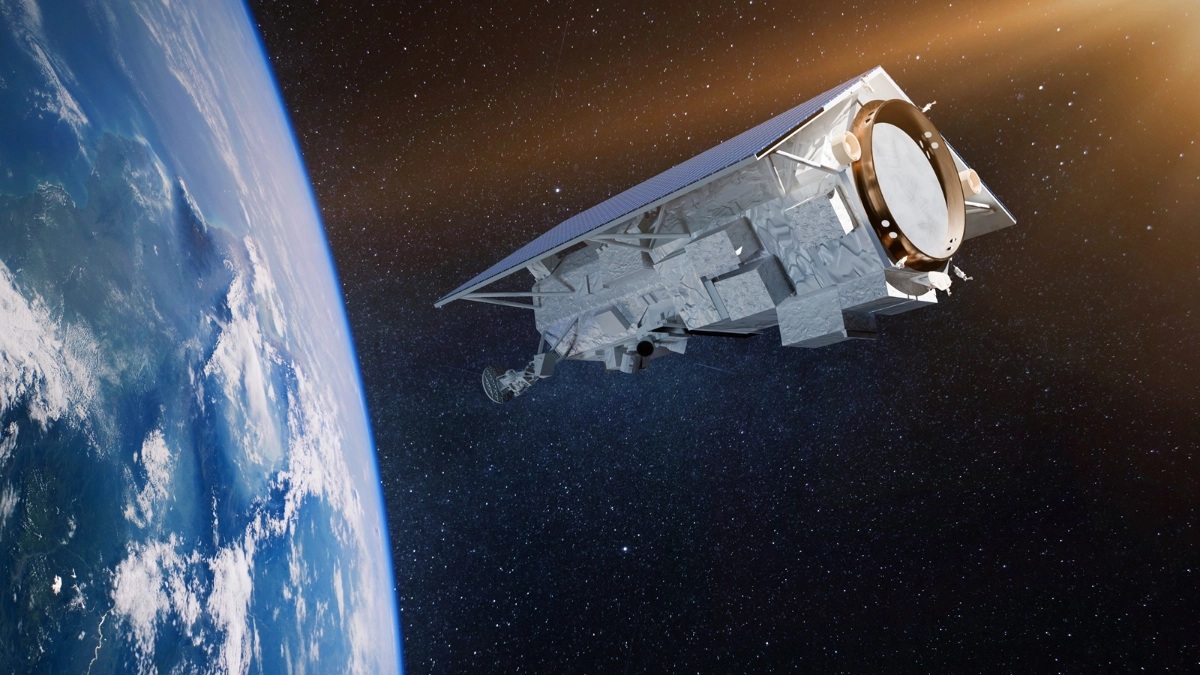
Teledyne Space provides EarthCARE imaging instrumentation
Image courtesy Teledyne Space
The EarthCARE satellite will launch from the Vandenberg Space Force Base in California, US on a SpaceX Falcon 9 rocket. Its mission is to enhance human knowledge of the role that aerosols and clouds play in our planet’s climate system. The satellite will use Teledyne Space Imaging’s instrumentation to capture data that will be sent back to the ground to assist in environmental monitoring and future decision-making. EarthCARE stands for Earth Cloud Aerosol and Radiation Explorer.

The EarthCARE project represents ESA’s biggest and most complex Earth Explorer mission to date. The satellite was designed and manufactured by a consortium of more than 75 companies, under prime contractor, Airbus. It will measure global profiles of aerosols, clouds and precipitation, focusing on radiative fluxes and derived heating rates. The EarthCARE satellite will orbit around 400 kilometres above the surface of the Earth in order to get as close as currently possible to the aerosols and thin clouds that are of particular interest.
Teledyne Space Imaging has provided a custom charge coupled device (the CCD243) for the satellite’s ATLID instrument. This LIDAR instrument has a high-spectral resolution receiver and depolarisation channel to ensure the delivery of high-quality atmospheric data. This specialist CCD has a high temporal resolution allowing it to capture detailed vertical profiles of aerosols and thin clouds via sophisticated sensor technology. The imaging sensors have been designed and optimised to operate at a wavelength of 355nm. The CCD243 sensor has dimensions of 6x6 pixels, 30 microns square, from which the signals are combined into a single pixel for each atmosphere layer.
Gabriela Druitt, Director of Engineering at Teledyne Space Imaging says: “Our sensor technology will help the ESA and JAXA EarthCARE satellite deliver crucial insights, not only into how aerosols, clouds and precipitation influence the impact and effect of solar and infrared radiation on the planet, but what this could mean for how we tackle climate change. We are proud to be involved in such an important, ambitious Earth Exploration mission and excited about the launch in California that is rapidly approaching.”
Teledyne Space Imaging specialises in engineered and complex space solutions, manufacturing advanced electronics, imaging and sensor systems for operation in the global space economy.