New satellite to monitor sea-level rise from space
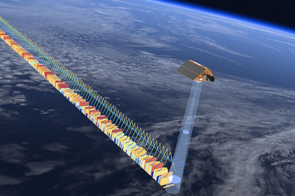
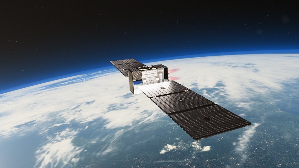
Above: Sentinel-6B will orbit in tandem with Sentinel-6 Michael Freilich for its first year, allowing for precise cross-calibration between the two instruments.
Credit: ESA/ATG Medialab
Sentinel-6B is the latest satellite in the Copernicus programme; the European Commission’s world-leading Earth observation initiative delivered in partnership with the European Space Agency (ESA). It is one of a series of missions that date back to 1992, giving a reliable record of global sea-level rises over more than three decades.

Sentinel-6B is scheduled for launch on 17 November 2025 from Vandenberg Space Force Base, California, on board a SpaceX Falcon 9 rocket.
Space Minister Liz Lloyd said: "Sentinel-6B will help protect the lives and livelihoods of communities right here in the UK and across the world, whether that’s defending our coastal towns from flooding, safeguarding our ports and maritime industries, or helping families and businesses prepare for the future.
"This mission shows how UK space expertise delivered through ESA and Copernicus activities delivers down-to-earth benefits that matter to people every day."
Developed through a long-standing cross-Atlantic partnership between the European Commission, ESA, EUMETSAT, NASA, and NOAA, it will build on the success of its predecessors, including the Sentinel-6 Michael Freilich mission, to extend the record of global sea-level measurements with the highest possible accuracy. This will enable scientists and decision-makers to track sea-level changes and act decisively.
Beth Greenaway, Head of Earth Observation Theme at the UK Space Agency, said: "The launch of Sentinel-6B marks a major milestone in our shared efforts to understand how our oceans are responding to the changing climate, extending and enhancing scientists’ ability to monitor accelerating sea-level rise and provide robust, trusted data and information on its impacts. This will help governments and society to make informed decisions about adaptation and strengthen resilience for the hundreds of millions of people living in coastal regions worldwide.
"As world leaders gather in Brazil for COP30, space-based observations are essential tools for understanding and adapting to our changing environment."
Andrew Saulter, Scientific Strategic Head for Ocean Forecasting at the Met Office, added: "Global coastlines are home to some of the world’s largest cities, vitally important energy and maritime trade infrastructure and economic activities such as industry, agriculture, fisheries, tourism and internationally important sites for wildlife. Monitoring and understanding changing sea levels and storminess is critical to helping sustain coastal communities and environments, through both present-day risk mitigation efforts and designing adaptations to climate change impacts to come."
The Copernicus Sentinels are a fleet of satellites dedicated to climate and environmental monitoring, each designed to observe specific aspects of the Earth system. Together, they form the backbone of the Copernicus programme, providing a continuous stream of high-quality Earth observation data for decision-making and practical applications worldwide.
This data helps emergency teams map floods and wildfires in real time, supports farmers by monitoring crop health and soil moisture, and improves air quality forecasts by tracking pollutants and greenhouse gases. By providing this critical information, the Sentinels empower governments, businesses and communities to make informed decisions for resilience and sustainability.
Sentinel-6B uses advanced radar altimetry and microwave radiometry to measure the height of the sea surface, significant wave height, and global wind speeds. With sea-level rising faster than expected, timely monitoring is essential to anticipate trends and inform policy decisions in the rapidly changing natural environment. These observations improve weather and climate forecasts, support disaster preparedness, enable communities to make informed decisions, complement local monitoring, and extend coverage where satellite data offers the greatest value.
The global reach highlights the importance of international collaboration to deliver data that can be used by communities worldwide. As part of Jason Continuity of Service (JASON-CS), Sentinel-6B will operate in tandem with its predecessor, Sentinel-6 Michael Freilich, for its first year, allowing for precise cross-calibration and ensuring continuity of the sea-surface height since records began decades earlier.
The UK’s industrial role in the Sentinel-6B mission is primarily through Airbus Defence and Space UK in Stevenage, where the spacecraft propulsion system was developed and tested, alongside UK expertise from the University of Reading and elsewhere. The hydrazine propulsion system with eight thrusters will maintain the 1.3-ton satellite in the correct orbit for its mission. The UK Space Agency continues to facilitate UK industry and scientific participation in Copernicus and promotes the use of Copernicus data across government, academia, and business to support environmental management, civil security, and climate resilience.
This has been an exceptional year for Earth observation launches, with major European missions such as Biomass, Sentinel-4, Sentinel-5, Sentinel-1D and the France–UK bilateral mission MicroCarb successfully deployed. With Sentinel-6B and HydroGNSS about to take flight, the momentum shows no sign of slowing.
The UK has many varied roles in these missions, from detectors to calibration, science to strategy. As the UK Space Agency concludes its year as Chair of the Committee on Earth Observation Satellites (CEOS), championing efforts to ‘Unlock Earth Observation for Society’, it continues its long-standing contributions to ESA, Copernicus and EUMETSAT, underscoring the UK's commitment to international collaboration and leadership in space-based services.