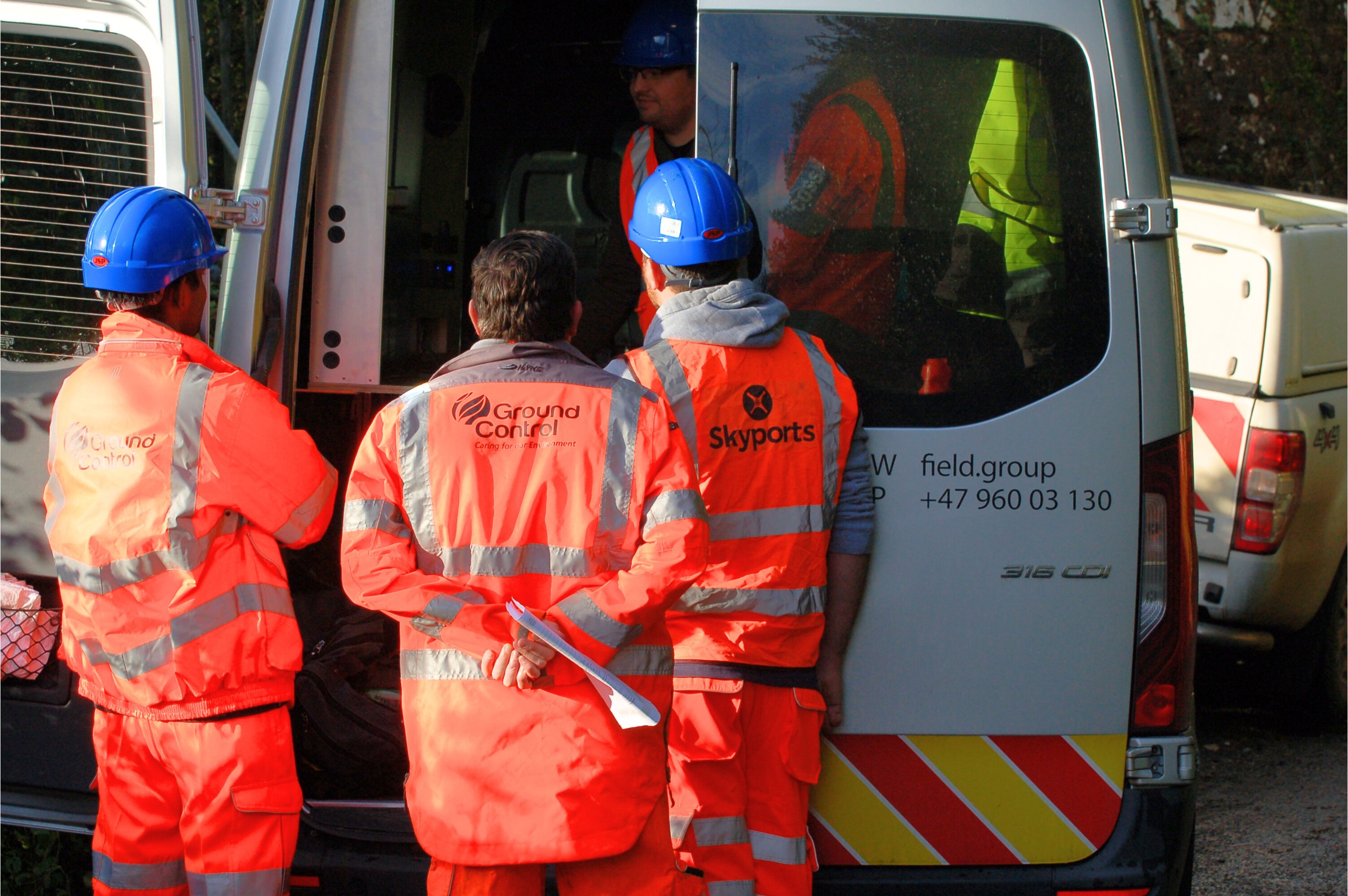
Skyports and Ground Control launch drone survey with Network Rail
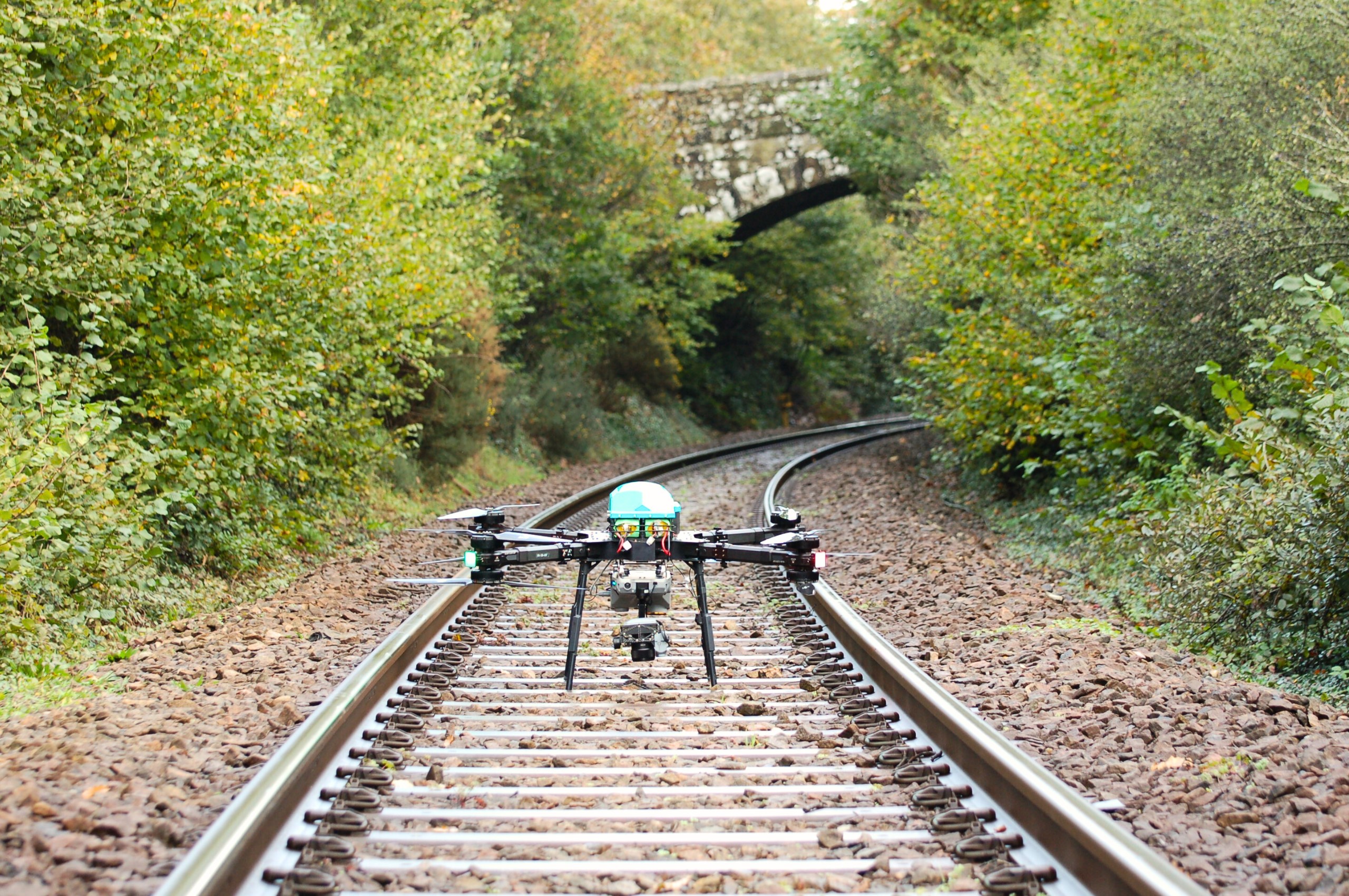
Image courtesy Skyports
The project combines Skyports’ best-in-class drone services and Ground Control’s longstanding relationship with Network Rail to streamline infrastructure surveys for Network Rail. By capturing mission-critical environmental data, vegetation encroachment, tree type and health, the service enables the UK railway infrastructure owner to make data-led decisions on their vegetation management, reduce impact on biodiversity, respond rapidly to risks and limit delays for rail users.

Network Rail has over 10,000 miles of railways to manage and maintain. Inspection of these routes extends beyond addressing vegetation overgrowth issues, it also involves monitoring the diverse flora and fauna that grow in these ecosystems. Managing vegetation must strike a balance between keeping railways clear and safe while protecting natural habitats.
Also, while currently optional, the requirement for developers and landowners to protect and improve natural habitats around the UK, is set to become mandatory within the next 18 months.
In combining Ground Control’s expert arboreal and biodiversity experience and Skyports’ long-range drone service and AI data capture capabilities, Network Rail is obtaining a new level of insight about the habitats alongside their railway lines.
The announcement follows a trial period in Cornwall last year during which Skyports and Ground Control performed asset inspection and data capture flights for ecological survey, vegetation and plant health monitoring and to identify tree species. Skyports Drone Services and Ground Control aim to roll out the new service to rail, roads and power transmission and distribution companies across the UK and Ireland.
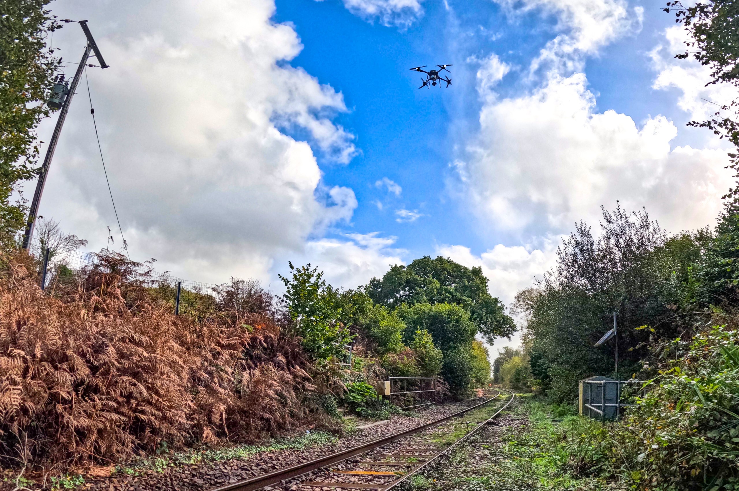
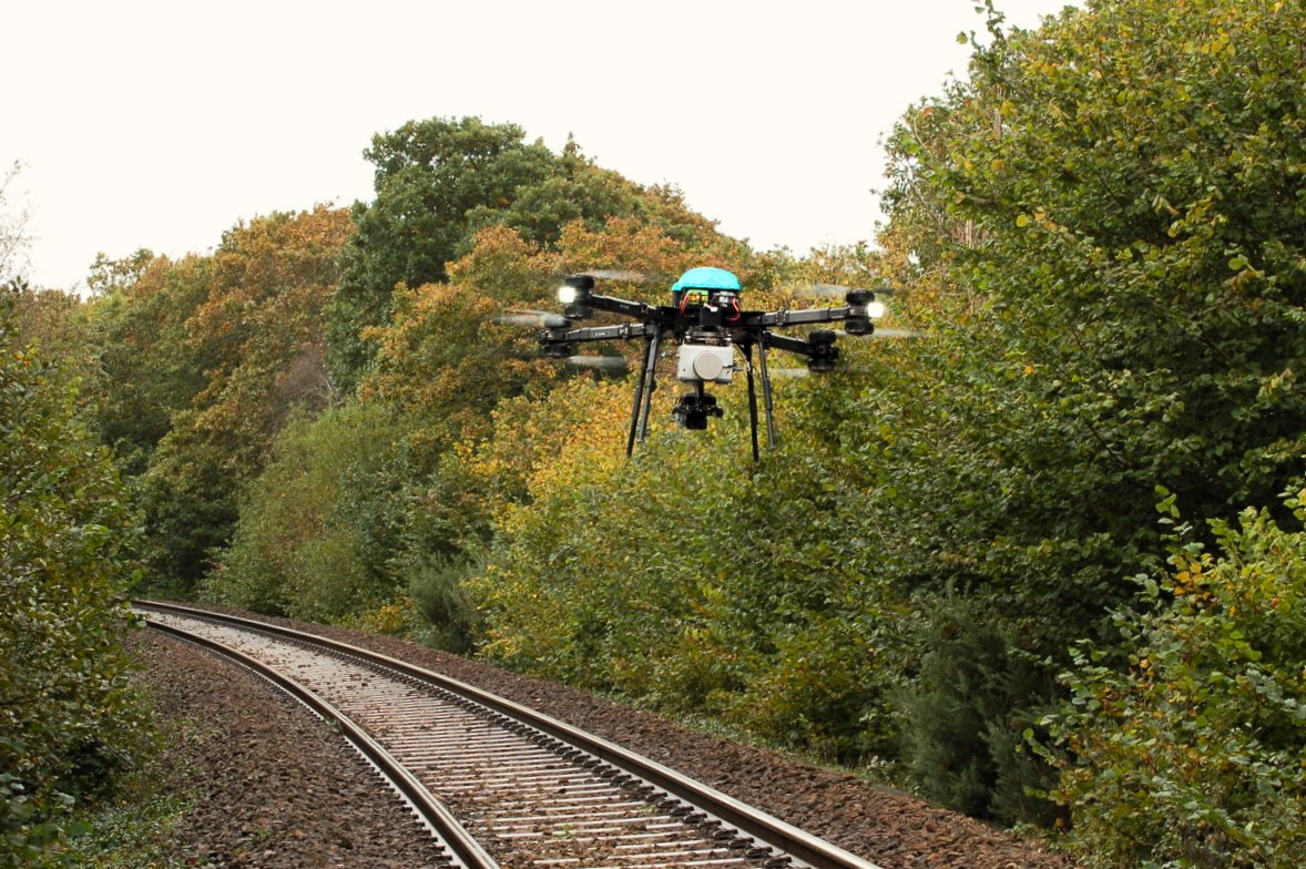
Skyports’ will deploy its Stellaire (previously Field) Explorer drone. The aircraft, which Skyports onboarded to its fleet in December 2023, is specially designed for linear infrastructure inspection and capable of simultaneously capturing a range of datasets, including nadir and oblique images, thermal images and LiDAR.
Peter Stirratt, Survey & Inspection Project Lead, said: “This is the start of a great journey. The adoption of this new technology by Network Rail is a testament to the industry’s readiness to embrace innovation and find alternative solutions that are faster, more sustainable and safer.”
“We look forward to expanding our service with Ground Control to continue to demonstrate how drone services can transform data capture capabilities.”
Austin Brown, Infrastructure Director, at Ground Control, said: “This initial project has been a real success with our main objectives being achieved. Having the ability to collect a multitude of high-quality data will allow our clients and operational teams to make better informed decisions, while improving safety, environmental and financial performance.”
A new view of the world: how it works
Traditional methods of conducting vegetation surveys of railways come with several downsides. Be it the risks to personnel accessing dangerous railway settings, the limitations of flying helicopters in poor weather, or the limited data capture capabilities on manually controlled drones.
Unlike existing methods, Ground Control and Skyports’ solution, powered by Stellaire’s (previously Field) aircraft and data analytics system, is fully automated, capable of being flown beyond visual line of sight (BVLOS) and carries multiple sensors capable of simultaneously capturing a range of data.
Data collected by the Skyports and Ground Control service is instantly and securely uploaded to Stellaire’s analytics suite where AI is used to provide near real-time insights, depending on customer requirements. Insights can be as detailed as single-tree analysis, which can identify species, tree height, crown radius and health. This data enables risk-based analysis and informed decisions on vegetation management, while mitigating against damage to natural habitats and reducing time and cost.
The remotely operated drone flights reduce personnel requirements and limit the need for staff to access dangerous locations. Furthermore, with zero operating emissions, the service is significantly more sustainable.